

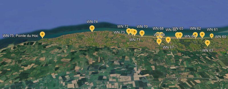
| Widerstandsnest 74, Pointe de la Percée |
 |
| Garrison |
| 80 – 100 men |
| Unit |
| 9. Kompanie, Grenadier-Regiment 726, 716. Infanterie-Division (bodenständig) under operational control of 352. Infanterie-Division 10. Flugmelde-Leit-Kompanie, Stab III. Abteilung, Luftnachrichten-Regiment 53 Kriegsmarine Personnel |
| Armament |
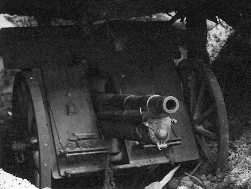
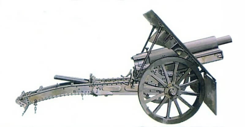
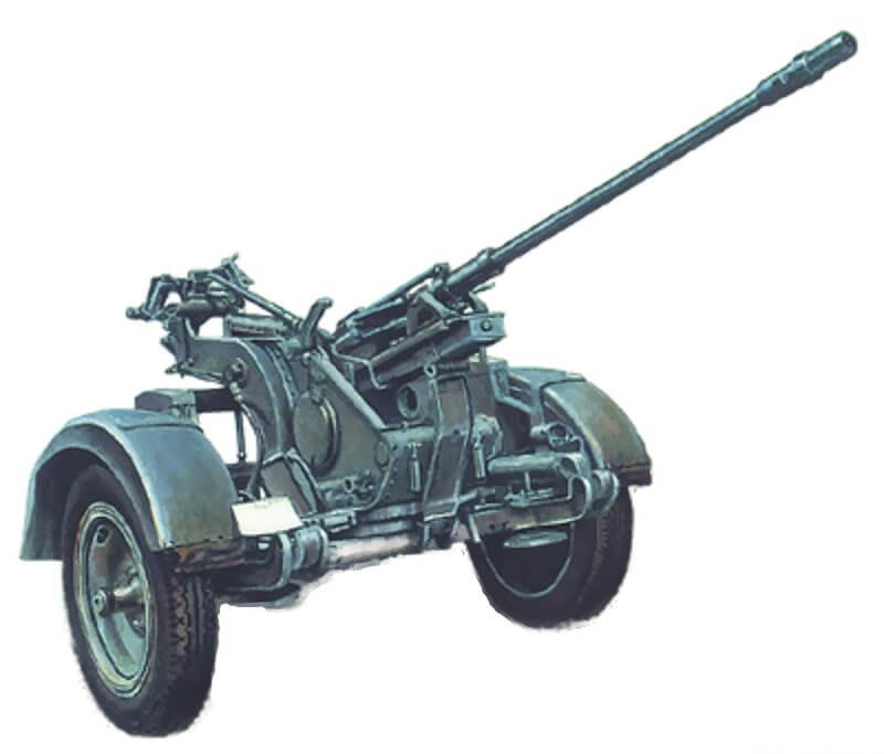
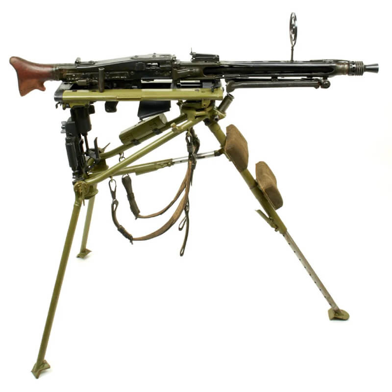
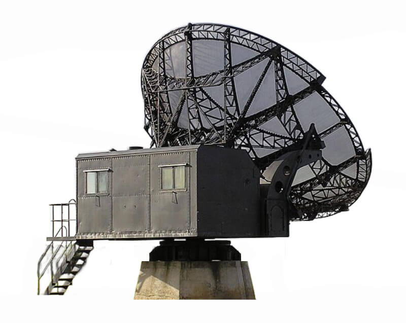
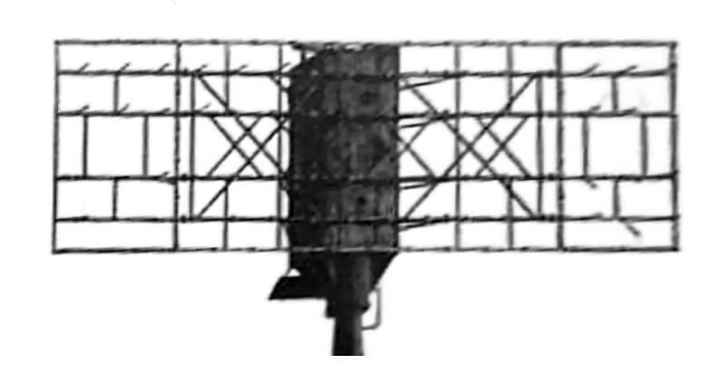
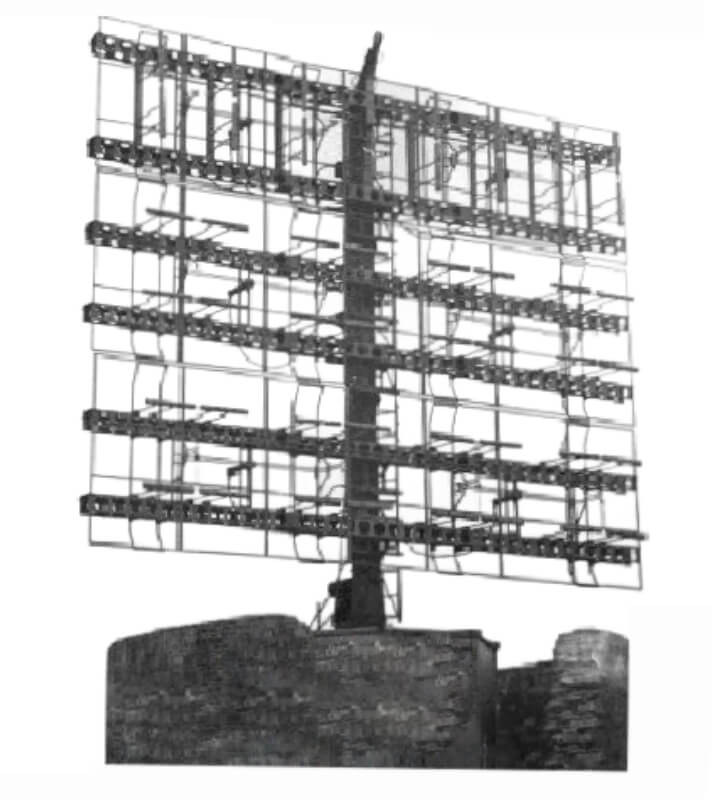
| * Two Czech Škoda 7.65-centimetre field guns * Four 2-centimetre Flak 30 * Maschinengewehr 34 * Maschinengewehr 42 * Two Funkmessgerät 65, Seeriese FuMO 214 Würzburg-Riese * One FuMO 2, Seetakt * One Funkmessgerät 80, Freya |
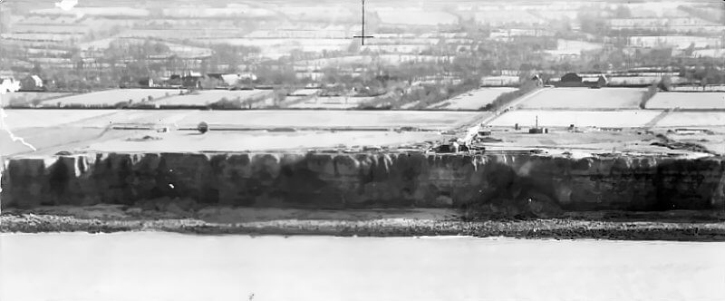
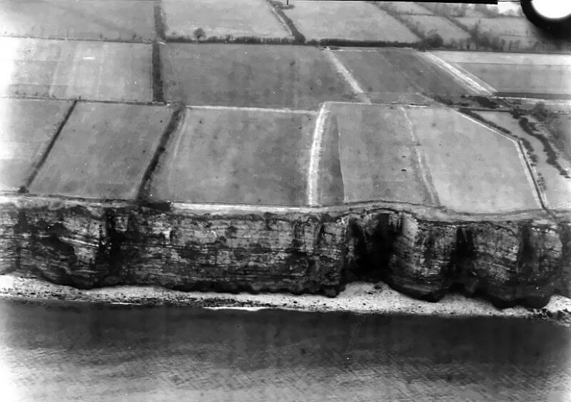
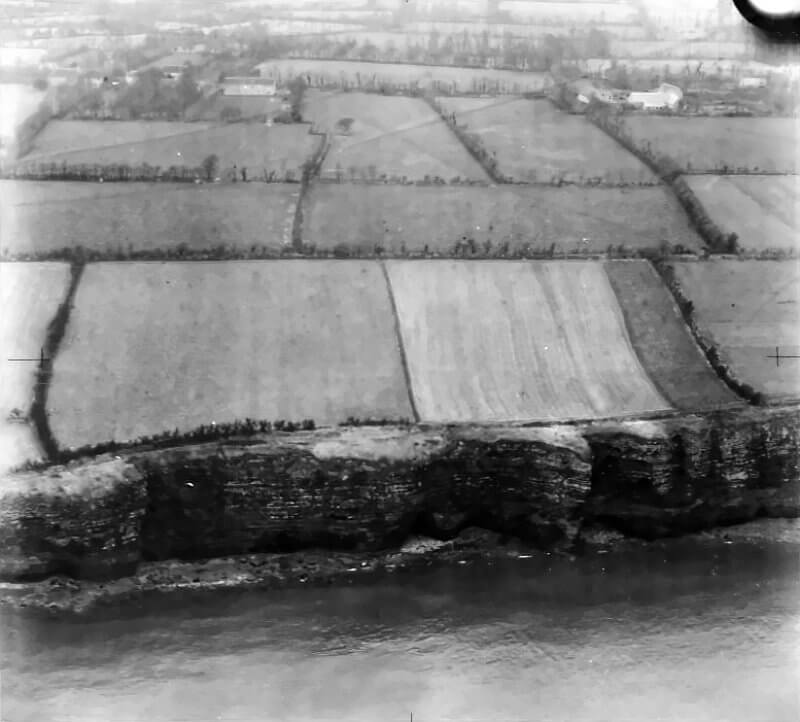
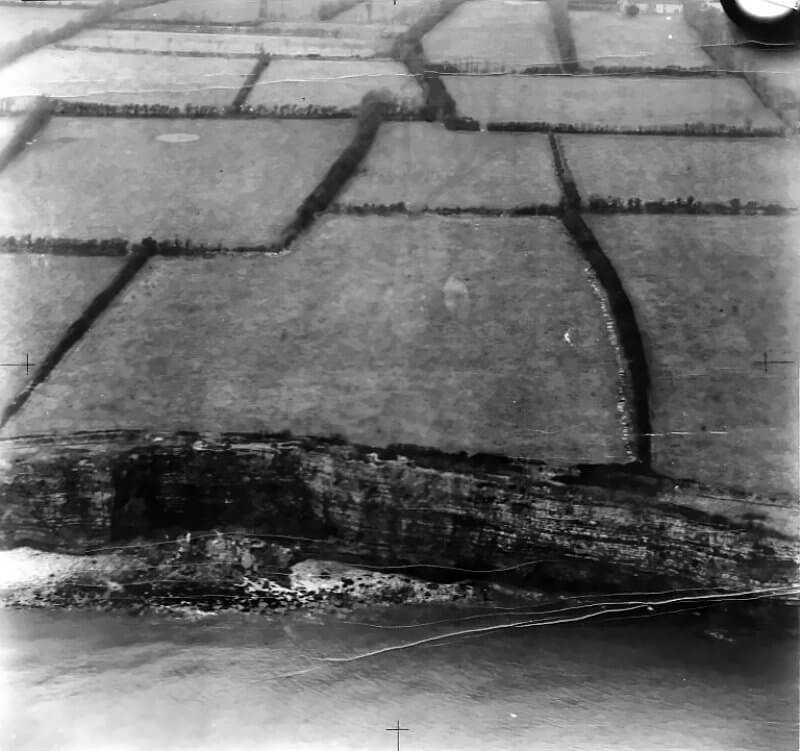
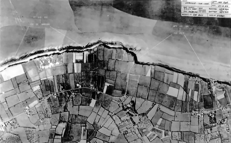
Widerstandsnest 74, also called Stützpunkt Saint-Quay or StP Le Guay, stands on the far western flank of Omaha Beach in Normandy. It occupies the cliff top northeast of Englesqueville-la-Percée, with a clear view over the sea approaches to Vierville-sur-Mer. Unlike the beach-level resistance nests armed chiefly for anti-ship or anti-tank roles, its main function is as a radar detection and observation post for the Kriegsmarine. But it also contains a Gun position. It forms part of the Atlantic Wall’s early-warning network, intended to monitor Allied air and naval activity along the Normandy coast.
By early June 1944, the strongpoint consists of several radar installations supported by defensive works built into the cliff-top terrain. Its mission is twofold. First, it must provide constant surveillance of the coastline, detecting enemy movements at sea or in the air long before they reach the shore. Second, it must protect the coastal sector around Pointe de la Percée from any approach on Omaha’s western flank. This position serves both as the eyes of the German coastal command in this sector and as a local defensive stronghold should Allied forces attempt a landing or infiltration from the west.
| Multimedia |
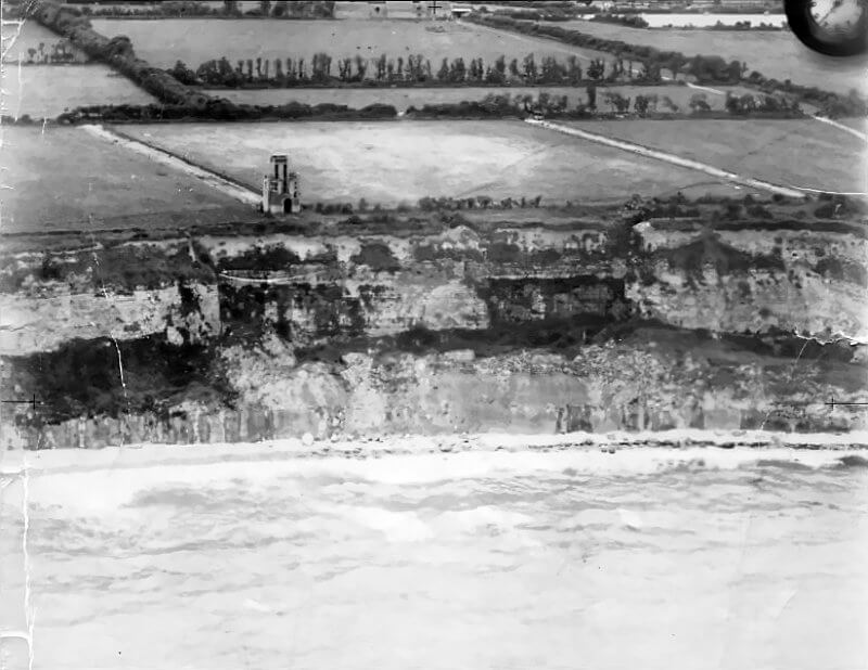
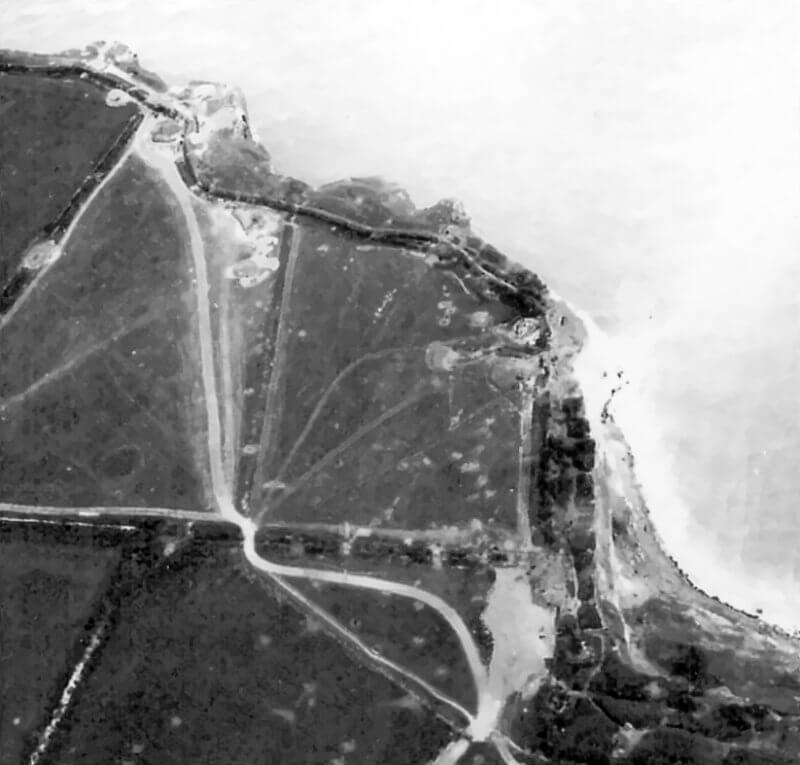
| Construction and Layout of Widerstandsnest 74 |
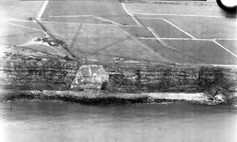
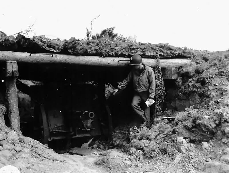
By June 1944, Widerstandsnest 74 is a compact but well-defended German position. It consists of two parts. The position includes two 7.65-centimetre field guns of Czech origin (Škoda manufacture) overseeing omaha beach and a radar and observation complex built into the cliffs of the Raz de la Percée.
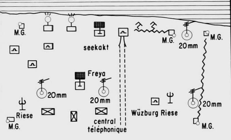
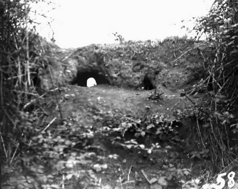
The position contains several permanent concrete structures alongside field fortifications. A small Sonderkonstruktion naval observation bunker stands on the cliff edge, giving uninterrupted views over the western Omaha sector and the Channel. This post allows observers to spot and report targets or direct fire if required. Close by are four concrete radar platforms built to carry different antenna types. Each is reinforced with steel-rebar concrete to support the weight of the radar arrays and protect the machinery from blast.
Personnel shelters and ammunition stores are dug into the site, with earth-covering to absorb shellfire. These bunkers house radar operators, living quarters, generators, and a communications hub that serves as the main telephone exchange for the sector. A network of trenches and shallow tunnels links the shelters, radar mounts, and fighting positions. This allows the garrison to move between points under cover and out of sight of enemy observers.
Defensive positions include at least four Tobruk pits for machine guns, placed to cover likely approaches to the cliff-top complex. There are also open mounts for light anti-aircraft weapons, positioned to engage low-flying aircraft or strafing runs. The arrangement of structures follows both the technical needs of the radar equipment and the natural contours of the promontory. Antennas and the observation post occupy the highest ground for maximum range, while bunkers and stores are concealed behind earthen banks.
Camouflage netting and paint schemes help the strongpoint blend into the rocky cliff face when viewed from the air. The result is a hardened, self-contained installation where high-technology detection equipment is combined with classic Atlantikwall defensive design, allowing Widerstandsnest 74 to watch the sea approaches while remaining ready to repel an attack.
| Multimedia |
| Defensive Systems and Infrastructure of Widerstandsnest 74 |
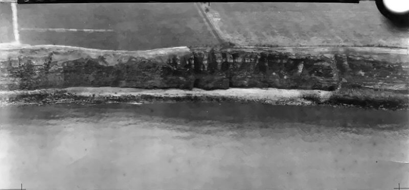
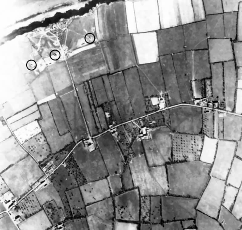
By June 1944, Widerstandsnest 74 is encircled by multiple layers of obstacles and passive defences, despite its main function as a Kriegsmarine radar and observation station. The plateau above the Raz de la Percée cliffs is ringed with barbed wire entanglements. In the open ground, the garrison lays coils of concertina wire to block likely infantry approach routes, while additional belts of wire guard the cliff edges and choke points. These barriers are designed to funnel attackers into pre-sighted kill zones covered by the strongpoint’s machine guns and flak positions.
Minefields strengthen the wire obstacles. Anti-personnel S-Minen and standard anti-tank mines are laid in irregular patterns across the plateau and along approach paths. A registered minefield, code-named Mf 24, lies to the south of the position, forming a protective inland belt intended to stop or delay an advance from the rear should enemy troops bypass other defences.
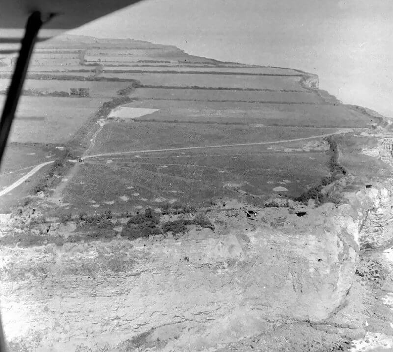
The terrain itself provides a formidable natural shield. Sheer cliffs drop away to the sea, making any direct assault from the shoreline virtually impossible. The only realistic access points are from the east, via Vierville, or along a narrow inland track, both covered by mines, wire, and interlocking fire from Widerstandsnest 74 and neighbouring positions.
Widerstandsnest 74 is tied into the German coastal command structure by a buried field telephone network. Lines run from its communications bunker, the site’s “main exchange”, to the regimental or battalion command post in Vierville, enabling the radar operators to relay sightings of Allied naval or air activity in real time. The observation post is integrated into the artillery fire-control system, able to direct batteries of 10,5 cm and 15,5 cm howitzers positioned inland. German doctrine places such forward observers in strongpoints specifically to bring rapid, accurate indirect fire down on any target within range of Omaha Beach.
The radar station’s role in the early-warning network is critical. Using both radio and telephone, its personnel pass on plots of Allied ships or aircraft to higher command and to nearby Flak batteries. To sustain continuous operation, Widerstandsnest 74 houses heavy diesel generators in protected underground chambers, with sound-muffling to reduce detection.
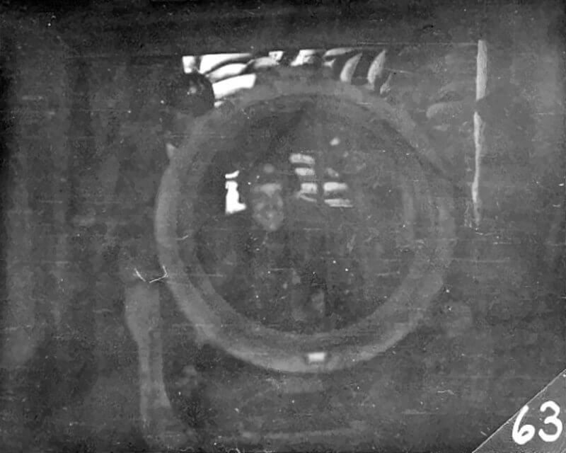
For night defence, the position mounts at least one searchlight, identified as item no. 4 on German site diagrams, near the cliff edge. This light can sweep the Channel and the skies, illuminating surface craft for coastal batteries or tracking low-flying aircraft for the Flak crews.
The combination of man-made barriers, natural cliff defences, secure communications, and independent power supply ensures that Widerstandsnest 74 is no soft target. Even though its primary mission is radar surveillance, it is hardened, armed, and integrated into the wider Atlantic Wall system, capable of holding out under attack until reserves or supporting fire can be brought to bear.
| Multimedia |
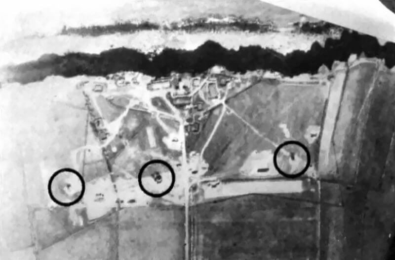
| Armament and Weapons Emplacements of Widerstandsnest 74 |
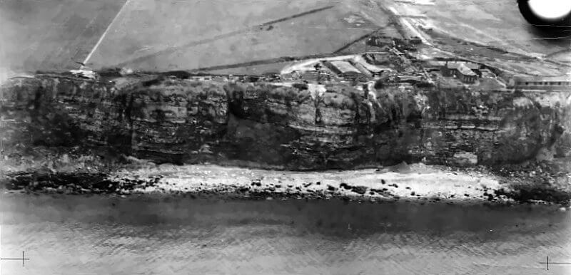
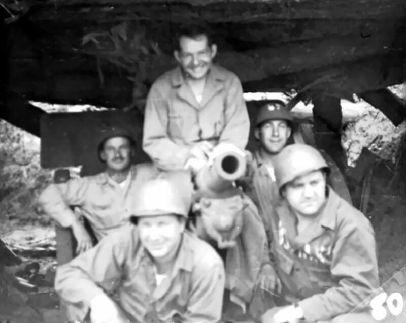
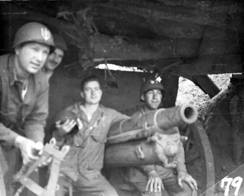
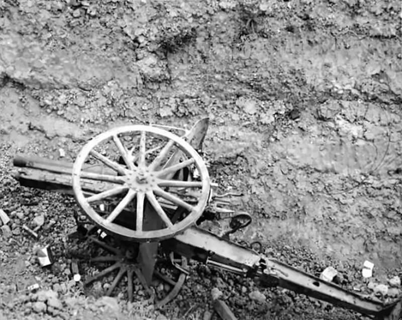
By early June 1944, most of Widerstandsnest 74’s armament is relatively light in calibre but varied in type. However it also contains two Škoda 7.65-centimetre field guns of Czech origin. This reflects its function as a support position rather than a primary anti-invasion beach fort. Its weapons are selected to protect the radar installations, defend the cliff-top approaches, and provide flanking fire toward neighbouring sectors.
The two Škoda 7.65-centimetre field guns are placed at the top of the cliff at the Fosse de Louvières. These would be sited in open positions near the tip of Pointe de la Percée. Their role would be to deliver enfilade fire along the length of Omaha Beach from west to east. This placement takes advantage of the coast’s curve, which allows guns here to fire diagonally across the landing areas.
No confirmed mortar positions are recorded in Widerstandsnest 74, but a light 5-centimetre or medium 8-centimetre Granatwerfer 34 could have been issued to the infantry detachment. Mortars would allow the garrison to hit targets hidden from direct-fire weapons, such as dead ground inland or at the cliff base. If Widerstandsnest 74 lacked its own mortars, it could call on Widerstandsnest 73 or other nearby strongpoints for indirect fire support.
In addition to the artillery, the cliff between La Percée and Vierville is rigged with demolition charges. These consist of 270-millimetre shells embedded into the rock face, spaced roughly every 100 metres.
Four 2-centimetre Flak 30 anti-aircraft guns are mounted in open gun pits. These rapid-firing 2-centimetre guns are primarily for engaging low-flying aircraft, but here they also serve in an anti-personnel and light anti-vehicle role. From the cliff-top, their elevation offers wide fields of fire. They can sweep sections of the Dog Beach sectors and the approaches from Pointe du Hoc, though at extended range. The guns are positioned to cover different arcs, ensuring that each is able to engage both air and surface targets.
Four machine guns, either MG 34 or MG 42, are sited in Ringstand (Tobruk) bunkers. These small, open-topped concrete emplacements have a rotating mount to give 360-degree coverage. Each is positioned to cover a different sector. One faces east toward Vierville, enabling fire along the bluff line toward Widerstandsnest 73. Another covers the inland approach from the south. The remaining positions cover the western and northern approaches, including any possible cliff ascent. These machine guns are the main close-defence weapons, intended to deliver grazing fire along the cliff base and across the plateau.
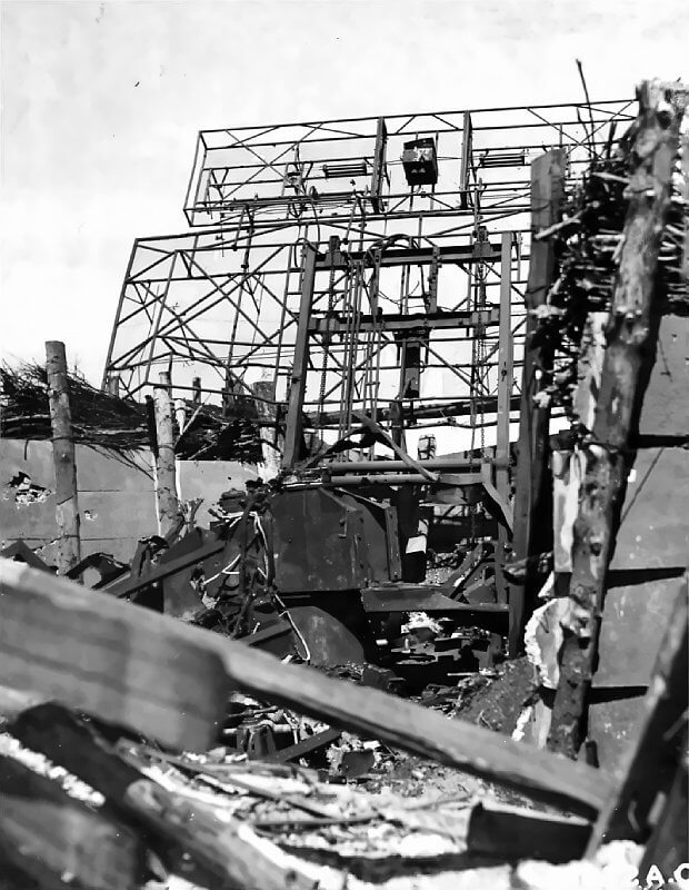
The radar equipment at Widerstandsnest 74 is also a vital part of its defensive capability. The site includes two Seeriese FuMO 214 radar dishes of the Würzburg-Riese type, one FuMO 2 Seetakt long-range naval radar, and one FuMG 80 Freya early-warning radar. These systems detect Allied ships and aircraft well before they are visible, allowing the garrison to alert higher command, direct artillery fire, or trigger Luftwaffe fighter interception. This electronic detection extends Widerstandsnest 74’s defensive reach far beyond the visual horizon.
All weapons are arranged to create interlocking fields of fire. The 20-centimetre and machine guns cover each other’s blind spots and overlap with those of Widerstandsnest 73. For example, Widerstandsnest 74’s eastern machine gun can sweep the cliff base toward Widerstandsnest 73, while Widerstandsnest 73’s weapons can fire toward Widerstandsnest 74. This crossfire ensures that any attacking infantry must face multiple angles of fire. The flanking positions relative to the beach mean that no landing zone in this sector is safe from enfilade until both Widerstandsnest 73 and Widerstandsnest 74 are neutralised.
Although it lacks the heavy coastal guns of other Omaha strongpoints, Widerstandsnest 74’s mix of anti-aircraft cannon, machine guns, and observation assets makes it a well-balanced defensive position. Its firepower is sufficient to delay and disrupt any assault on this flank, protect the radar installations from commando attack, and support the wider defence network with early warning and flanking fire.
| Multimedia |
| Multimedia |

| Radar |
| Garrison and Organisation of Widerstandsnest 74 |
By June 1944, the garrison of Widerstandsnest 74 is a mixed detachment from several branches of the German armed forces. Its make-up reflects the dual nature of the site as both a coastal defence point and a radar surveillance station.
Administratively, Widerstandsnest 74 falls within the coastal sector of the 716. Infanterie-Division. In the spring of 1944, this sector is reinforced and partially taken over by the 352. Infanterie-Division. By the eve of the invasion, responsibility for the Vierville–Englesqueville area is under Grenadier-Regiment 916 of the 352. Infanterie-Division, though some original 716. Infanterie-Division personnel remain.
The combat detachment consists of a Heer infantry platoon from Grenadier-Regiment 726, originally part of the 716. Infanterie-Division. At full strength this platoon numbers between thirty and forty men. It comes from the regiment’s 9. Kompanie, suggesting a heavy weapons platoon. These troops man the MG 42 machine guns in the Tobruks, act as riflemen and lookouts, and provide close protection for the radar station. They maintain trenches, guard the perimeter, and are responsible for engaging any attacking infantry. The platoon is led by a Leutnant or experienced Feldwebel. It has Machine Gun teams, rifle sections, and possibly a small mortar squad. In the weeks before D-Day, the position is likely reinforced or partially replaced by elements of Grenadier-Regiment 916 from the 352. Infanterie-Division, bringing higher readiness and manpower.
The radar and signals element belongs primarily to the Luftwaffe. Records show that the 10. Flugmelde-Leit-Kompanie of III./Luftnachrichten-Regiment 53 is stationed at Widerstandsnest 74. This is an air reporting and fighter control company, numbering perhaps fifty to sixty men. Commanded by an Oberleutnant, the unit consists of radar operators, electronics technicians, plotters, and communications specialists. They operate and maintain the FuMG 80 Freya, FuMO 214 Würzburg-Riese, and FuMO 2 Seetakt radars. Their task is to detect and track Allied aircraft or naval forces, plot their movements, and relay this information to higher commands such as the 7. Jagddivision or III. Flakkorps.
Although the site is Luftwaffe-manned, it is a Kriegsmarine-initiated installation. The Seetakt radar is a naval system, and one or two Kriegsmarine technicians are likely present. A naval officer may be responsible for its operation, but the bulk of daily work falls to the Luftnachrichten personnel.
Support functions are also present. The garrison needs mechanics for the generators, men to handle ammunition and supplies, and at least one trained Sanitäter. In a small position like Widerstandsnest 74, these duties often fall to men with other primary roles, such as a radioman doubling as medic.
Command is likely shared. The senior Heer officer or Non-Commisioned Officer directs ground defence, while the Luftwaffe Oberleutnant oversees radar operations. In combat, the tactical control of the strongpoint probably rests with the combat commander, but coordination is constant. The radar crews alert the infantry to approaching threats, while the infantry protects the radar equipment to keep it operational.
The total garrison strength is estimated between fifty and eighty men. This is larger than a standard Widerstandsnest because of the radar operators. All personnel are familiar with the terrain, weapon range cards, and defensive plan. By June 6th, 1944, they are well dug in and integrated into the coastal defence network covering the western end of Omaha Beach.
| Widerstandsnest 74’s Role in the Omaha Beach Defence Strategy |
Widerstandsnest 74 occupies a singular position in the defensive scheme for Omaha Beach. It is the westernmost resistance nest in the fortified line that stretches for roughly seven kilometres from Widerstandsnest 60 at Colleville-sur-Mer in the east to the cliff-top at Englesqueville-la-Percée in the west. In this role, it acts as a flank anchor, closing the open end of the position where the sandy shore gives way to the sheer cliffs of Pointe de la Percée. Its location prevents any Allied attempt to turn the beach defences from the west, whether by scaling the cliffs or landing beyond Vierville-sur-Mer. Minefields and interlocking fields of fire from its weapons make that flank impassable without a deliberate assault.
The strongpoint also has a secondary role as a rearward guard for the Vierville “Exit D-1” draw. Its enfilading position allows fire across the top of the draw and along the approach road, should U.S. troops force their way inland. In this way, it ties together the beach positions with the next German strongpoints to the west, notably those at Pointe du Hoc and Grandcamp.
Widerstandsnest 74 is not an isolated post but the central element in a small defensive group. Immediately to the east, Widerstandsnest 73 at Vierville-sur-Mer mounts a 7,5-centimetre Pak gun and mortars that sweep the Dog Green and Charlie sectors. Together, Widerstandsnest 73 and Widerstandsnest 74 create a crossfire over the western beach sectors and the Vierville exit. To the west, a small outpost at the tip of Pointe de la Percée, designated Stützpunkt 74a or Widerstandsnest 76 “Le Guay,” guards the cliff-top approaches and the radar installations. This post, manned by a section of troops with machine guns and an observation point, is integrated into Widerstandsnest 74’s defence plan as part of “Gruppe Percée.” It is intended to prevent a commando-style landing aimed at the radars.
The site’s elevation and observation facilities give it an important role in the depth of the defence. Unlike the forward-facing beach strongpoints, Widerstandsnest 74 stands slightly back from the shoreline. From its SK-type observation bunker, its observers can see the western Cotentin approaches, the length of Omaha Beach, and the inland terrain. It is linked by telephone to artillery batteries in the rear and can direct their fire onto Allied units advancing from the shore.
As a radar station, Widerstandsnest 74 is also part of the Atlantic Wall’s early-warning network. Its Freya, Seetakt, and Würzburg-Riese sets are capable of detecting Allied aircraft and naval forces before they are visible. In theory, this allows time to alert higher commands, scramble fighters, or ready coastal batteries. The site is therefore both a local defensive position and an intelligence outpost for the entire sector.
The importance of Widerstandsnest 74 is underscored by the fact that it is assigned as a priority target for pre-invasion bombing. U.S. Eighth Air Force heavy bombers are tasked to strike it in the early hours of 6 June 1944. Two groups of B-24 Liberators, forty-eight aircraft in all, are allocated to attack the radar station and its supporting defences as “Objective 35.” The intention is to blind the early-warning network and reduce the site’s ability to direct fire. Poor visibility and timing mean that the bombing falls largely inland, but the allocation of such resources shows that Allied planners view Widerstandsnest 74 on a par with the main beach bunkers and coastal guns.
During the landings, Widerstandsnest 74 remains largely intact and unassaulted, its position on the cliff-top and the press of battle on the beach keeping it out of immediate U.S. reach. Its eventual capture comes only on 8 June, when elements of the 5th Ranger Battalion and the 175th Infantry advance inland and clear the radar site. By then, its radars have been destroyed and its tactical role rendered moot by the collapse of the coastal defence line, but its clearance removes the last organised German post on Omaha’s western flank.
In the German scheme of defence, Widerstandsnest 74 exemplifies the combination of traditional fortification and advanced technology. It links the cliff defences to the beach nests, gives depth to the fire plan, and extends the defenders’ vision far out to sea and sky. Even though Allied countermeasures limit its effectiveness on D-Day, its design and endurance demonstrate the layered, mutually supporting nature of the Atlantic Wall in the Normandy sector.
| Sources |
An impressive share, I just given this onto a colleague who was doing a little analysis on this. And he in fact bought me breakfast because I found it for him.. smile. So let me reword that: Thnx for the treat! But yeah Thnkx for spending the time to discuss this, I feel strongly about it and love reading more on this topic. If possible, as you become expertise, would you mind updating your blog with more details? It is highly helpful for me. Big thumb up for this blog post!